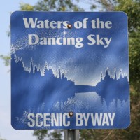
The Waters of the Dancing Sky Scenic Byway is Minnesota’s northernmost scenic drive, stretching roughly 229 miles along the state’s top border from International Falls toward the North Dakota line. Winding through a mix of woods, farmland, rivers and lakes, this unforgettable route follows the Rainy River from International Falls to Baudette, rolls through fields of lady’s slippers and wildflowers, and links to the Pine to Prairie Birding Trail west of Warroad. Along the way you’ll find world-class fishing on Lake of the Woods and the Rainy River, a long sandy beach at Zippel Bay State Park, abundant birding, charming small towns and plentiful outdoor adventure. The byway’s evocative name comes from the “dancing sky” of the northern lights that frequently shimmer over these far-northern landscapes thanks to minimal light pollution